Thursday 20 December 2018

Land's End to John O'Groats 2019


Having halted my Land's End to John O'Groats walk in the summer, I was anxious to get back on the trail ASAP to enable me to complete the entire walk within less than one year. The original plan was to walk the whole route in one but due to unforeseen circumstances, I decided to temporarily halt the walk in Hay-on- Wye. This time, rather than setting off in the summer, I am planning to start hiking in the middle of April 2019. There are two reasons for choosing April, one being that it will mean that I finish the walk in well under a year and also, I should hopefully finish before the main midge season starts in Scotland. I also intend wild camping more often on this trip. Although I camped a fair bit in the summer, I mostly used official campsites as I found locating wild campsites in the areas I was walking through difficult. 


Now however, I will be walking through more remote hill country so I can avoid using too many campsites, some of which in the summer in the West Country were grossly overpriced. My route will be roughly as follows, Offa's Dyke path to Chirk followed by a combination of the Maelor Way, South Cheshire Way, Gritstone Trail along with a few more minor trails to reach the Pennine Way near Hayfield. Having walked the Pennine Way in 2015, I am not interested in walking it again so soon so will be leaving it fairly quickly to follow various trails including the Pennine Bridleway to the Forest of Bowland. After reaching the Lake District I will walk the Cumbria Way to Carlisle, then a combination of the Annandale Way, West Highland Way, Rob Roy Way, East Highland Trail and the John O'Groat's Trail to the end.

Sunday 9 December 2018

The Coast to Coast Walk 2011 - Borrowdale to Patterdale


For Day 3 of our 2011 Coast to Coast hike, we had a short, easy day climbing over to Grasmere from Borrowdale. Here, we caught a bus to Ambleside as we could not find a BnB in Grasmere. The following day, we headed through the Grisedale Pass to Patterdale where we camped at the Side Farm campsite. The video quality in some scenes isn't the best as it was filmed on a fairly basic, pocket camcorder.

Wednesday 28 November 2018

The Coast to Coast Walk 2011 - St.Bees to Borrowdale


In 1998, I solo walked my first ever long-distance trail, The Coast to Coast walk through northern England taking twelve days to complete it. This was for me the realisation of a long-held desire to walk a long distance trail and sparked a fascination with long distance hiking that I have to this day. In 2011, I decided that I would hike the trail again only this time, I would be hiking with a friend. Another difference to my 1998 hike was that a tent formed the majority of the 'accommodation´ along the way, camping being something that I had not even considered on that first hike. The 2011 hike was a great success, although we did suffer some pretty horrible weather over the last three days but overall, we thoroughly enjoyed the walk, which took us thirteen days. I have since hiked the trail for a third time with my wife and had a more leisurely trip this time taking sixteen days to complete it. Why am I writing about my 2011 hike it now? Well, after completing the hike, I made a Youtube video of clips and photos taken along the way and unfortunately included quite a lot of music that violated Youtube's  copyright policy, which caused them to mute the audio track. I have just begun re-editing the material from this trip into short videos, this is the first of these. 

Saturday 17 November 2018

The Pennine Way's Best Day

Having set off to walk the Pennine Way in the summer of 2015 with a friend, I finished the walk alone as he was forced to pull out at Middleton in Teesdale with a knee injury. My first day walking solo in superb weather to Dufton was for me the best day on the entire trail. This video shows the main highlights along with photos taken along the way.

Saturday 10 November 2018

Lands End to John O'Groats hike Part 8


Days 19 to 21 of my Lands End to John O'Groats hike from Chepstow to Hay on Wye proved to be my last on the trail for now but also passed through some of the most beautiful and stunning scenery of the hike

Saturday 3 November 2018

Climbing MontaƱa Blanca in Tenerife

A video of a recent walk to the summit of MontaƱa Blanca on the lower slopes of Teide, Spain´s highest mountain in the Las CaƱadas National Park


Monday 29 October 2018

Land's End to John O'Groats hike Pt. 7

After 4 days spent with my wife visiting friends in south Devon, I return to the trail with new (bigger) shoes and new glasses as I head for Bridgwater


Friday 26 October 2018

Lands End to John O'Groats - Walking the South West Coast Path


Engine houses on the South West Coast Path taken on my Land's End to John O'Groats walk 2018

One of the things I most regret about my Land's End to John O'Groats walk in the summer was my decision to walk the Lands End Trail in preference to the South West Coast Path. My plan was to walk from Land's End to St. Ives using the SWCP before heading inland to pick up the LET. My reason for this was that I thought that I would make faster progress taking a fairly direct route through Cornwall and Devon. 

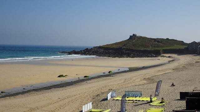
Porthmeor Beach, St. Ives on the South West Coast Path taken on my Land's End to John O'Groats walk 2018


This was a decision I came to regret. The LET proved to be a time consuming, frustratingly overgrown and irritatingly difficult route consisting of mostly local footpaths knitted together to form a 'trail'. There were numerous times when the path simply disappeared or didn't appear at all. On one occasion, I spent some time trying to smash my way through an overgrown path using my two trekking poles but in the end, gave up and retreated back to the previous village and road walked around the obstruction.

St.Ives harbour on the South West Coast Path taken on my Land's End to John O'Groats walk 2018


Even when climbing the slopes to the summit of Brown Willy on Bodmin Moor, I never located a path despite being on the route I had downloaded onto my GPS. Instead, I found myself ploughing my way through waist deep ferns as I struggled to the summit. Eventually, I gave up trying to follow it and instead followed the myriad of tiny rural lanes that criss-cross the south-west. Much as I dislike road walking, this was preferable to the frustrating struggle to stay on the LET.

Cape Cornwall on the South West Coast Path taken on my Land's End to John O'Groats walk 2018


In contrast, the sections of the South West Coast Path I walked were simply stunning. The first section from Land's End to St.Ives was pretty tough but traversed some magnificent scenery, including some exquisite, remote white sand beaches, accessible only to those prepared to walk some distance from the nearest road. I spent the night at the end of my first day wild camping alongside the path just after Zennor and this was my favourite campsite of the trip. Just yards from the shore, I was lulled to sleep by the sound of the waves after enjoying dinner outside my tent as I watched the sunset over the sea. Over the next few days, I switched between the SWCP and the LET but most of the good memories are of the SWCP.


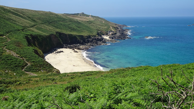
Portheras Cove on the South West Coast Path taken on my Land's End to John O'Groats walk 2018


I was fortunate that I was walking in one of the most memorable UK summers for many years and as I romped along the coast, I looked forward to cresting each headland as I knew that as I reached the top, I would be greeted with yet another awesome stretch of golden, sandy beach stretching for miles, the rollers breaking on the shore creating a scene more reminiscent of an idyllic Caribbean island.

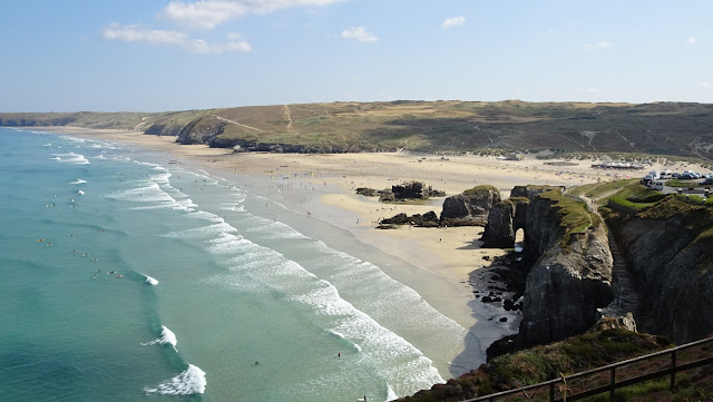
Perranporth on the South West Coast Path taken on my Land's End to John O'Groats walk 2018


In weather the UK experienced in the summer, there can't be anywhere in the world more staggeringly beautiful. By the time I reached Padstow, I decided to head inland again and left the SWCP for the last time. With the benefit of hindsight, it is a decision I would not make again.

Saturday 20 October 2018

Wednesday 17 October 2018

Alone Again Or? - Solo Hiking Land's End to John O'Groats

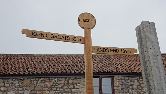
Cheddar LEJOG signpost taken on my Land's End to John O'Groats hike 2018
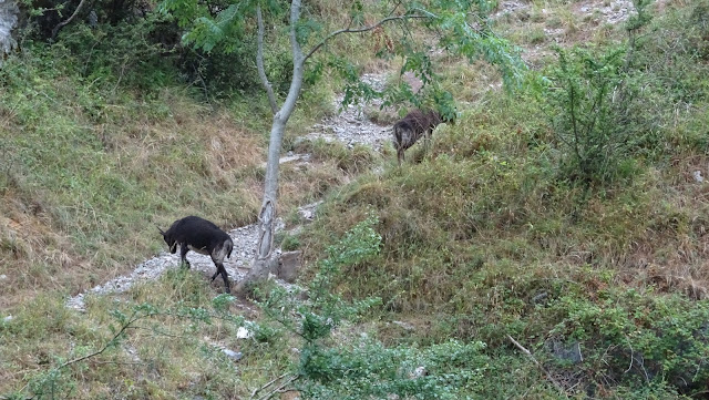
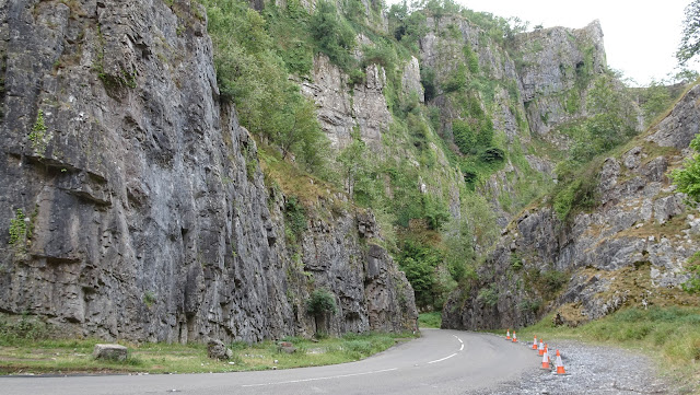
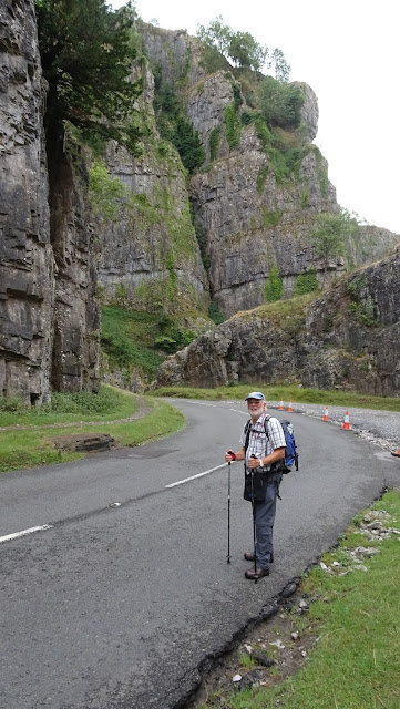
Much as I like hiking alone, there are times when it is nice to have some company, particularly on a hike such as my recent Lands End to John O'Groats hike where you are unlikely to meet anyone following the same route. I was therefore pleased when Mike, a friend of mine who lives near the village of Cheddar in Somerset, joined me for a day's hike over the Mendips. Initially, we followed the road out of Cheddar up through the gorge, the spectacular cliffs towering above us as we watched the wild goats clambering up the steeps rocky walls.

Wild goats in Cheddar gorge on my lands end to john o'groats hike
Wild Goats in Cheddar Gorge

Cheddar gorge on my lands end to john o'groats hike

My friend Mike on my Land's End to John O'Groats hike 2018

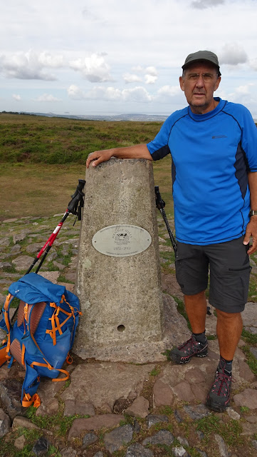
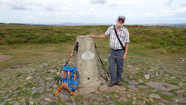
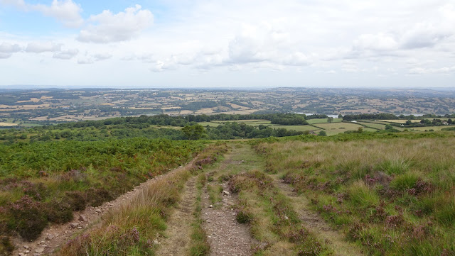
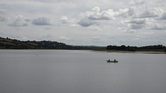
Near the top of the climb, we left the road and headed into the hills in the direction of Beacon Batch, the highest point of the Mendips, from where we had stunning views across the Bristol Channel into Wales and the surrounding countryside. After spending some time on the summit, we descended to Blagdon Lake before following the Monarch's Way to the village of Barrow Common where we relaxed with a couple of beers before Mike's wife collected us and drove us back to their house where I was treated to a great dinner and more beer, a perfect end to a great day's walk.

Me on Beacon Batch on my lands end to john o'groats hike

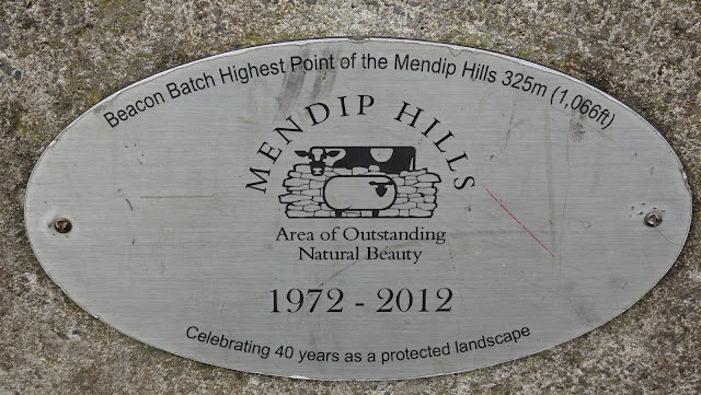
Sign on Beacon Batch, highest point of the Mendip Hills taken on my Land's End to John O'Groats hike 2018

My friend Mike on Beacon Batch, highest point of the Mendip Hills, taken on my Land's End to John O'Groats hike 2018

Descending Beacon Batch taken on my Land's End to John O'Groats hike 2018
On Beacon Batch, highest point of the Mendips

Blagdon Lake, taken on my Land's End to John O'Groats hike 2018
Blagdon Lake
The following day, as Mike waved me off from our previous day's finish point, I began to ponder my preference for solo hiking. Much as I had enjoyed walking with Mike, I was glad to be alone again, making my own way through the countryside. This contradiction is something that I ponder often when walking as, although I love walking alone, I also like to have someone to share the trail with, even if it's simply meeting another hiker doing the same trail or chatting to them in a campsite or pub in the evening.
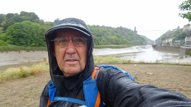
Clifton Suspension Bridge on my lands end to john o'groats hike

Clifton Suspension Bridge  taken on my Land's End to John O'Groats hike 2018
Passing Clifton Suspension Bridge in heavy rain
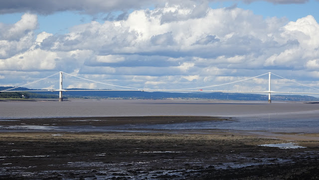
M4 Bridge over the Severn taken on my Land's End to John O'Groats hike 2018

Severn Road Bridge over the Severn into Wales  taken on my Land's End to John O'Groats hike 2018
M4 & Severn road bridges
Now, having enjoyed Mike's company and hospitality the previous day and feeling re-energised, I resumed my Land's End to John o'Groats walk and hiked around Bristol in torrential rain before heading along the banks of the Severn and on into Wales.

Sunday 14 October 2018

Lands End to John O'Groats hike Part 5

Days 8 & 9 of my LEJOG hike. After a three day lay off in Launceston for treatment on my infected toe, I return to Jamaica Inn to recommence my hike.


Tuesday 2 October 2018

Gear I used on my LEJOG hike

A brief overview of some of the main items of gear used on the 400 miles I walked on my LEJOG hike in July and August 2018 between Lands End and Hay on Wye


Tuesday 25 September 2018

Land's End to John O'Groats Part 3 - Porthtowan to Newquay

Part Three of my LEJOG walk as I abandon the Lands End Trail and head back to the South West Coast Path between Porthtowan and Newquay. It is on this stretch where I encounter the first of the numerous problems faced on my walk.


Thursday 20 September 2018

Land's End to John O'Groats Pt.2 - Zennor to St.Hilary

Day two of my LEJOG hike from my wild campsite on the SWCP near Zennor to a campsite in St.Hilary. It was today that I discovered that my decision to head inland and follow the Lands End Trail may not be such a great idea - 27k


Tuesday 18 September 2018

Thursday 13 September 2018

Climbing Roque del Conde, Tenerife - the wrong way


Climbing the prominent Roque del Conde, a 1,000 metre mountain close to my home in south Tenerife 12/9/2018. I have climbed this many times before using the usual route from the town of Arona but for this hike, I went 'off piste' and climbed it from the south via a rough, rocky and pathless ridge.

Monday 3 September 2018

LEJOG Afterthoughts

My route so far

Having halted my LEJOG walk at Hay on Wye and having had time to reflect on the numerous problems that beset me along the way, I thought I would do a breakdown of the trip including thoughts on the pieces of kit that I thought performed really well and those that didn´t. 
My reasons for calling a halt to the walk weren´t because of any physical problem, all of the problems I suffered in the early part of the walk had been resolved by the time I reached Hay-on-Wye. 
As I said in a previous post, during a phone call, my wife had expressed concern over the amount of time the walk was going to take when taking into account all of the delays and this combined with my concerns over her health meant I wanted to be present at some doctors appointments she had coming up. Also, because of the amount of days I had been forced to take off, the funds I had for the walk had diminished substantially, even though I was still only in South Wales. 
Overall, discounting the non-walking days, I was quite pleased with the distance I covered, which averaged around 19 miles a day. I hope to be able to return in the spring or early summer of 2019 to continue the walk.


Walk Statistics

Total Distance Walked - 396.5 miles/634k
Total Days - 34 days
Total Days Walked - 21
Total Days Camped  - 12 (3 wild)
Average Daily Distance -18.8 miles /30.2k
Longest Day - Barrow Common to Chepstow - 34.1 miles/54.6k
Shortest Day - Glasbury to Hay on Wye - 5.5 miles/8.8k

Biggest Gear Failures

La Sportiva Ultra Raptors - Amazingly, these were my biggest problem in the early part of the walk. I say this because I have walked hundreds of miles in the same shoe/sock combination in the past with zero problems. In the first few days, I developed a large blister on the ball of my left foot, which burst causing me quite a lot of discomfort. I also developed a blister on the toe next to my big toe and various other hotspots all on my left foot. The other problem was a painful and swollen big toe, also on my left foot, which eventually became infected. Despite having walked not only in the same brand but in the same pair of shoes in the past, my left foot felt too big for the shoe. I can only put this down to the fact that the Raptors are quite a close fit and with the very hot and humid weather in the UK at the time, can only assume that my feet swelled in the heat. 


Decathlon Forclaz 500 shirt - I have to say that generally, I love Decathlon´s clothing and indeed, most of my hiking clothing comes from the store but this shirt was a mistake. It was sold as an item to be worn during long treks but I should have been alerted to the fact that the composition of the fabric was 70% cotton & 30% polyester. At times, my back was drenched in sweat and after two or three days, large light ´streaks´ had developed in the dark blue fabric where my rucksack straps sat. I binned it after about four days. I should have known better than to use a piece of gear that I hadn't  previously worn on a walk.

Mountain Warehouse Active Trainer Socks - I bought these as I thought lighter, thinner socks would help with the foot problems I was having by cooling them down and giving me more room in my shoes. They were very lightweight with a mesh top and because I purchased another item, I got both pairs for half price. I didn´t expect too much from them but I must say I expected them to last more than the few days that one pair did. Whilst pulling them up,  my thumb went straight through the back of the sock.

Biggest Gear Successes

Wild Camp end of Day 1 on the SWCP

Geertop Pyramid Peak 1 man tent -  I totally loved this. I had limited experience of using this tent before setting off but this is now firmly my first choice tent. Having recently been using my Trekkertent Stealth 1 on walks, I decided I wanted more space and two entrances into the tent. I also wanted a side entrance tent as the Stealth is front entrance, which I found difficult, particularly when getting out of it as you sleep with your back to the door. The Geertop was superb however. The luxury of having two doors and vestibules was a revelation as I could put my rucksack and wet gear in one and use the other for getting in and out and stowing my food and cooking gear. The tent uses trekking poles and I found the 'A' frame set-up very solid and although I never experienced any really wild weather, it stood up well to heavy rain and some blustery winds. The only negatives I found were the tiny zipper pulls, which I resolved with the addition of some ties. I also found that the two large ventilation panels at either end need setting up with care to avoid letting rain in. Otherwise, I can see this being my go-to tent for some time to come.


Mountain Warehouse Rash Vest - I bought this as a replacement after binning my Decathlon shirt. To be honest, I didn´t realise it was a 'rash vest' at the time, I just liked the feel of the material. It proved to be a great shirt and never got noticeably damp, even in the very hot conditions. I also liked the fact that even after walking in it for a couple of hot days, it still remained largely free from odours.

Viewranger App - Used this exclusively for navigation in conjunction with my Samsung Tablet and phone. A brilliant app

Samsung Galaxy Tab A 7" - Performed superbly in conjunction with Viewranger, which I had loaded with OS Landranger maps.

Decathlon Kalenji Trail Rain Jacket - Kalenji is the Decathlon brand name of their running gear and this lightweight rain jacket weighs in at just 250 grams and packs down really small. Although for the early part of the walk, I didn´t need it as the UK was in the middle of a heatwave, I loved the lightweight feel of this jacket when I did have to use it, which kept me dry in some torrential rain near Bristol.

La Sportiva Ultra Raptors - Perversely, these feature in both the Success and Failures list! My wife delivered a brand new pair of these trail shoes to me in Devon in a half size bigger than the ones I had started off with and all of my foot problems vanished as I enjoyed hiking in them as I have over the past few years.

Biggest Mistakes


Filtering water - Carelessness when filtering river water while wild camping was, I believe, the reason for my severe bout of sickness and diarrhoea in South Molton. While collecting and filtering water from the river at my wild camp on the Tarka Trail, which was surrounded by cattle fields, I stupidly re-inflated my dirty water bottle by putting it to my mouth a number of times. I´m convinced this is what caused my illness.

The Magnificent South West Coast Path

Leaving the SWCP - Although easy in hindsight, my choice of route, which was to go inland and follow the Land´s End Trail, was a mistake. I had assumed that taking a more direct route inland would be shorter and easier but the opposite proved to be the case. Invisible and absurdly overgrown paths, poor or no waymarking etc. made this ´trail' an annoying, time consuming irritation. At one point, while following the exact route using GPS on the slopes of Brown Willy on Bodmin, the so-called LET led me through waist high ferns strewn with granite boulders with absolutely no sign of a path. I arrived at the summit hot and very irritated after a tiring ´bushwack´ through the overgrown hillside. Were I to start LEJOG again, I would stick with the magnificent SWCP, even though the early section from Lands End to St. Ives proved to be tough walking.

The Black Mountains in the Brecon Beacons

Best Walking

As suggested above, the SWCP was simply majestic. I really regret not sticking with this all of the way to Minehead. The Black Mountains section of the Brecon Beacons was also superb, with really scenic and remote feeling mountain country. Other highlights included the Wye Valley Walk from Chepstow to Monmouth, the Bodmin section (in spite of the LET) from Delford Bridge to Jamaica Inn over Brown Willy, highest point in Cornwall and the Mendips, including Cheddar Gorge and Beacon Batch, the highest point of the range.

Summit of Brown Willy


Saturday 18 August 2018

LEJOG Day 21 - Glasbury to Hay on Wye

The Black Mountains from the Wye Valley Walk

After breakfasting with a group of four French people at the guesthouse who were travelling around Wales, hiking and visiting historic sites, I set off from Glasbury following the Wye Valley Walk to Hay on Wye. This proved to be a pleasant riverside walk in beautiful scenery with the brooding, Black Mountains I had crossed the day before, forming a moody backdrop in the slightly gloomy morning. I was undecided as to what my plan was for the day. Hay on Wye was only around five or six miles but the next obvious stop along the way was Kington, a further 15 miles, making a walk of around 21 miles. I decided to wait until I reached Hay on Wye to decide what to do. I reached a point where the Wye Valley Walk offered high and low level options and decided on the low level option along the river, which I was enjoying walking along.

Monday 13 August 2018

LEJOG Day 20 - Abergavenny to Glasbury

I left Abergavenny  on a beautiful sunny morning  and began climbing steeply towards Sugar Loaf mountain. Today's  walk passed through the Brecon Beacon  National Park and proved to be the best and most scenic walking so far. At times, there was a real sense of isolation and remoteness. I reached the foot of Sugar Loaf  but had no intention of climbing it as I had a long day ahead with a number of steep climbs and I needed to conserve my energy. I had visited the summit in 1996 when staying with the Ramblers at the now boarded up hostel in Abergavenny, so had no desire to lug my full pack up there.

Sunday 12 August 2018

LEJOG Days 14 to 19 - Wiveliscombe to Abergavenny


Day 14 - Wiveliscombe to Bridgwater

Having broken my glasses in the bnb in Wiveliscombe, I had travelled to Newton Abbot after meeting my wife en-route. We were spending a few days with our friends Chris and Harry who had kindly invited us to stay with them. This gave me the chance to collect replacement glasses and new trail shoes my wife had brought with her, and also to take the opportunity for a break from the trials I had experienced so far. After a few days rest and relaxation with Ann at our friends, I returned to Wiveliscombe, scene of the broken glasses. After an incident packed trip, which involved being delayed by the discovery of a dead body in Taunton bus station, I eventually arrived back at the village where I had stopped walking a few days earlier and set off for Bridgwater. I was meeting my wife there as we had a room booked in an hotel. The walking was largely forgettable and mostly consisted of walking totally deserted, tiny rural lanes. The exception to this was the climb over the Quantock Hills where I had some  beautiful views from my elevated position. The walk ended with a tedious slog along country lanes and through estates into Bridgwater. 34.5k/21.5 miles

Saturday 4 August 2018

LEJOG Days 12 & 13 - South Molton to Wiveliscombe

Wimbleball Dam
LEJOG Day 12 - South Molton to Wimbleball Lake 36.2k - Cumulative 364.2k

After checking in at the The George hotel in South Molton, and attending to the usual hygiene and laundry chores, I decided to eat at the restaurant next door as the hotel didn't serve meals in the evening. Having enjoyed a nice, if slightly expensive meal, I returned to the hotel to watch some rubbish TV before dozing off some time later. After an hour or so,  I woke up feeling strange and realised that I urgently needed the toilet. The rest of the night was spent between the bed and bathroom as a I suffered an awful bout of sickness and diarrhoea. I spent the next two days holed up in my room at the hotel feeling dreadful but decided that I would continue the walk on the Monday. I suspected that my wild camp by the River Taw was the cause of the sickness as, while filtering water from the river, I had on a couple of occasions inadvertently put the neck of the bottle carrying the unfiltered water to my mouth.

Friday 27 July 2018

LEJOG Days 8 to 11 - Jamaica Inn to South Molton

Jamaica Inn to Chipshop

On the morning after my arrival at Jamaica Inn, I realised that I needed medical advice as my big toe on my left foot was swollen and  painful with an unpleasant looking discharge. Having sought advice, I spent three days in Launceston receiving treatment from the hospital for an infected toe. On the Tuesday, the fourth day since my arrival, I was returned to Jamaica Inn by John, proprietor of the beautiful St. Dominick Guesthouse in Launceston. I had stayed with him and his wife Suzanne for the three days and they couldn't have been more friendly and helpful. It was quite a wrench when it came time to say goodbye. After a short drive, I waved John off from outside of the Jamaica Inn and it wasn't long before I was swearing yet again at the Lands End Trail and regretting leaving the SWCP. I spent a frustrating hour losing the path and regaining it before eventually emerging onto open moorland and dropping downhill  to join a narrow tarmac road. Once again, my lack of faith in the Lands End Trail caused me to stick with the lanes, some of which were no more than tracks with occasional paved sections. The day turned into a long hot slog and I arrived at the campsite at the unlikely named village of  Chipshop. Despite being quite tired, I almost turned and left when receptionist asked for £27 for my tiny one man tent. 'All the pitches  are the same size and they all have electricity' she explained. Reluctantly, I paid up and pitched my tiny one man pyramid tent among the "glampers' tents and motorhomes
Jamaica Inn to  Chipshop 36k - Cumulative 241k


Bodmin ponies

Sunday 22 July 2018

LEJOG Days 5 to 7 - Newquay to Jamaica Inn


I left Newquay on another fabulous, sunny morning and set off along the SWCP to Padstow. I had the beginnings of a small blister on the ball of my left foot and had taken a rest day in Newquay in the hope that this would stop it developing into anything worse. As I progressed along the coast, I was becoming amazed at the sheer amount of stunning sandy beaches and coves I encountered as around each headland, another superb beach would be revealed. Unlike the rough, rugged section of the SWCP from Lands End to St.Ives, this section was much easier as it followed the tops of the cliffs, which made for easy, rolling downland type walking. Eventually, I left the path and followed a number of country lanes and paths into Padstow to avoid the long detour around Trevose Head. After pitching my tent at the Dennis Hill campsite, I headed into Padstow in search of dinner and passed the queues waiting in line for Rick Stein's fish restaurant. I found a pub by the harbour and as I ate my dinner, marvelled at how people could afford  £4.70 for a pint of fairly standard  lager. My foot was by now becoming quite painful and when I returned to my tent, I replaced the plaster on the ball of my foot but my big toe was now also becoming painfully swollen. 
Newquay to Padstow 29.2k - Cumulative 154.2k


Monday 16 July 2018

LEJOG Days 1 - 4 - Lands End to Newquay


  Having spent the previous night in the pub watching England getting knocked out of the World Cup with two German tourists, I woke early on the campsite in Sennen and headed for Lands End. I took my obligatory selfie by the signpost and set off along the coast for Sennen Cove. It was a beautiful sunny morning as I arrived at the stunning beaches but it was too early for breakfast as the beach cafes were only just opening, so I carried on and eventually turned inland to the village of St.Just where I found a cafe and had breakfast sitting at the side of the road. Returning to the coast path I followed it for many miles as it rose and fell, like a white knuckle ride but without the assistance of a train and with plenty of rocks and boulders thrown on the track for good measure. The plan was to follow this as far as Carbis Bay before heading inland and picking up the Lands End Trail. I reached the village of Zennor in the late afternoon and stopped briefly at the pub for a beer but soon pushed on as I had to find somewhere to pitch the tent because of a lack of campsites in the area. The coastal path continued to be very narrow and steep and by seven o'clock I was becoming a little concerned that I may not find anywhere  to camp when I suddenly came across a small patch of reasonably flat grass by the side of the path. I immediately pulled the tent from the rucksack and made camp and enjoyed one of the best views I have ever had while wild camping. After eating, I drifted off to sleep to the soothing sound of the waves crashing on the rocks. 
Over the next three days, I drifted between the coast path and the Lands End Trail but it soon became clear that this 'trail' was going to be time consuming and frustrating as the paths either disappeared and left you standing in a field with no obvious way out or were ridiculously overgrown. After one particular path, where I spent too much time trying to force my way through using my trekking poles, I gave up on the trail and reverted to the coast path. I have also been using country lanes as short cuts where the coast path takes lengthy detours around headlands. I am currently having a rest day in Newquay where I am staying in a hotel. I have covered 125 kilometres in the first four days, which I think would have been more had I not wasted time on the Lands End Trail.

Wednesday 4 July 2018

Last Minute Concerns

With only a week to go until I start my LEJOG hike, I am checking and re-checking everything in readiness for the trip. The main issue other than gear concerns, is the weather in the UK, which recently has been more like that of my home island of Tenerife. With the forecast looking set for more hot weather for the foreseeable future, I have found myself questioning my strategy for re-supplying with water. When hiking in the UK, because of the weight involved, I rarely carry more than a litre and this time I am planning to carry only around 850ml. I back this up by using a Sawyer mini water filter, which is able to filter dirty water making it very easy to pick-up from streams etc. along the way. I am becoming slightly concerned that streams and rivers may be drying up if there is no rainfall in the near future so I may end up carrying more, at least in the early part of the walk. I always used to hike with a minimum of two litres of water but since becoming more weight conscious and reducing my pack weight, I decided that the 50 gram weight of the Sawyer was preferable to the 1 kilo a litre of the water.


Sunday 24 June 2018

The Weigh-in

My worldy possessions for a couple of months
After months of agonising over weight, I have finally decided on what I am going to take on my LEJOG hike. Well, almost! There are still one or two small items that I may or may not take but they only weigh a hundred grams or so and won´t make that much difference to my final base weight. For anyone unfamiliar with the term, base weight is everything in your backpack minus consumables such as food, drink, gas and toiletries and I have managed to get mine down to 7.5 kilos. I could get it even lower but I feel that there is a fine line between reducing weight to make the hiking easier and comfort/safety. Ultra-lightweight hikers strive to keep their baseweight below 5 kilos and I can see that this is achievable, particularly if you live in a dry, warm climate but the UK is not exactly known for these type of conditions so a little more equipment is probably a wise choice. Plus, there are one or two 'comfort' choices I have made where I could probably have opted for something lighter or nothing at all.

Thursday 31 May 2018

A Roller Coaster walk

The Lands End Trail

Many years ago, while holidaying in St.Ives, Cornwall, I purchased a small walking guidebook written by the owners of a seafront shop making and selling ornamental glass items. As I chatted with the shop owner, she recommended one of the walks in the book which was an eight mile section of the South West Coast Path from Zennor to St.Ives. 'It will take you 4 hours', she said, and as we left the shop I inwardly scoffed that such a short distance would take us that long.

Saturday 5 May 2018

The John O'Groats Trail


Because of a lack of footpaths in the area, most LEJOG journeys end with a horrible slog along the A9 road to John O'Groats. However, recently, the creation of the John O'Groats Trail has meant that it is now possible to cut out most, if not all, of this unsatisfactory ending (or beginning) to most walkers End to End journey. At the moment, the JOGT, which mostly follows the coast from Inverness, is a 'work in progress' but the excellent website has divided the trek from Inverness into 14 stages. Using a green, amber, red, 'traffic light' system, the website advises the current state of each stage and at the moment, there are no red stages and only two or three 'amber' stages. Like most walkers, I have an aversion to walking on tarmac so I will be utilising the JOGT wherever possible and reverting to the A9 only where this new trail is unviable. Photos of the walk can be found on this link http://www.jogt.org.uk/gallery/


Thursday 19 April 2018

My LEJOG Kit List

Choosing which items of my kit I want to use on my LEJOG walk, which I am starting in July, is mostly straightforward so this list is basically copied directly from my 2015 Pennine Way list but updated to include more recent purchases. As I said in the PW post, I rarely buy really expensive gear as I do not backpack in winter conditions so I don't need really 'high-end' equipment. I also feel that many of the more expensive brands are over-priced and tend to look for good quality, middle range kit. I have stated elsewhere that I am a big fan of Decathlon, which is where I buy most of my clothing. I find that although the prices are very competitive, the quality is excellent and I have a number of their items that I have used fairly extensively on hikes that have never let me down. There are however one or two areas where I do spend more, particularly with camping gear and footwear, although having said this, the tent I am planning to use is a fairly low-priced Chinese, lightweight trekking pole tent. Again, after the tent, the most expensive, non-tech items on my list are my Ultra Raptor trail runners made by La Sportiva. I toyed with the idea of changing to a different shoe for the walk but eventually decided that as I have never had any foot issues on my hikes, I would buy another pair and continue with what I know works for me. This list obviously doesn't include consumables and I haven't listed all of the smaller items.

Geertop Tent

Wednesday 21 March 2018

The South Downs Way video

I finally got around to putting together video clips that I took on our South Downs Way hike in September 2017. I had trouble with the editing and some of the sound isn't very good.

Tuesday 27 February 2018

Mapping the End to End

OS mapping coupled with Viewranger

For my End to End hike in July, I have decided that I won't be taking any maps with me. Well, that is not strictly accurate, I will have OS mapping for the whole of the UK but I won't be taking any paper maps. I have made this decision for a number of reasons, one being the sheer quantity of maps required for a trip of this length makes it really impractical and I simply can't be bothered with organising the delivery of maps to me en-route.

Wednesday 17 January 2018

Lands End to John O'Groats - My journey through Britain

When I first took up hiking as a pastime, I read a number of books written by long distance hikers about their experiences on the trail. My attention was particularly grabbed by those written by ultra-long distance walkers and I eagerly devoured stories of these seemingly unattainable adventures with one in particular firing my imagination. The book was 'Journey Through Britain' by John Hillaby and by the end of it, although I wasn't really aware of it at the time, the book had sowed the seeds of a life-long ambition. Over the years, I became a member and walk leader for my local ramblers group and also enjoyed some long challenges including Wainwright's Coast to Coast walk, a walk I have completed three times, the Southern Upland Way, Pennine Way, West Highland Way and most of the Cape Wrath Trail.