
 |
Climbing to Great Shunner Fell |
Today, at only 12.5 miles was to be the shortest day of the whole trip. We walked into town to buy snacks and drinks for the day and headed out of Hawes on the road on a bright morning with the sun reflecting from the surface of the River Ure as we left the road and followed a path alongside a wall through a meadow, with only the piping call of oyster catchers disturbing the peace as they flew around above our heads, presumably in an attempt to warn us away from their nests. We crossed a number of meadows, which had been bedecked with buttercups on my trip the previous year and soon reached the hamlet of Hardraw. Hardraw is famous for being the location of England's highest single drop waterfall, which is curiously situated at the back of the Green Dragon pub, who charge for the privilege of visiting it. As it was quite early in the day, the pub was shut and because I begrudge having to pay to visit natural features such as waterfalls, we didn’t linger but located the start of the track to the summit of Great Shunner Fell. This track, although long at around five miles, is all uphill but not particularly strenuous as it isn’t steep. As we climbed quickly, the view back into Wensleydale opened out and in the fine conditions I was enjoying the walking and the feeling of being out on the hills again.
 |
On Great Shunner Fell |
It was along this climb to the summit that fairly large gaps developed between us as we climbed and I stopped frequently to let Alan catch up. Alan also expressed a dislike for the scenery, which was rolling peat moorland and this led me to the conclusion that he was not enjoying himself or was feeling out of sorts. I also wondered if I was walking too fast for him, something that he had commented on before, so deliberately attempted to slow my pace although I didn’t feel that I was walking any faster than normal. Eventually, we reached the summit and stopped for a break in the wind shelter for a break to eat and drink. The panorama from the summit was extensive with the Pennines stretching ahead for miles, the summit of great Dun Fell easily visible as the sun shone on the large, white ‘golfball’ of the radar station. As we rested, a walker arrived from the opposite direction and stopped for a chat and we discovered that he was out on a day hike and was heading for the summit of Lovely Seat across the Buttertubs Pass. We wished him well and set off again for the village of Thwaite and as we descended from the summit we could clearly see a few miles away, the Tan Hill Inn, England’s highest pub sat in total isolation surrounded by a sea of moorland. We descended further, stopping only to talk briefly to a group of walkers heading for the summit, and after negotiating an unpleasantly stony path, found ourselves deposited on the narrow road just outside of Thwaite.
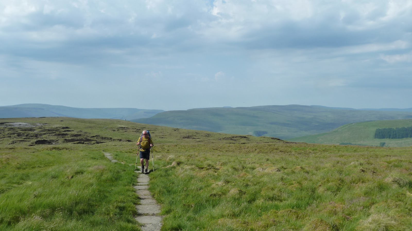
 |
Approaching Thwaite |

We strolled on in the sunshine down into the village where we stopped at a tearoom in the Kearton Country hotel and went in to order food. The young couple at the counter seemed to be totally disinterested in our presence and it was only after I picked up a menu from the counter and made my order that we were acknowledged at all. After we had ordered pots of tea and food, we headed back outside and found a table in the sunshine and it wasn’t too long before the tea was delivered to our table by the male half of the waiting duo with the same lack of interest as the female half had displayed when taking our orders.

Eventually, the food was delivered with the same lack of enthusiasm and although we both enjoyed the tea and food, we weren’t encouraged to linger and left without leaving a tip. We negotiated a narrow path around a house and out of the village before climbing a steep meadow on a path cut clearly through the deep grass. On my previous trip, a year earlier, this had been the only place on the whole hike where I had switched on my GPS unit as then, there had been no sign of a path and I didn’t want to climb the steep meadow only to find that the path didn't exit from the top. We skirted around past Kisdon House and picked up a narrow, stony path above Upper Swaledale as the river snaked its sinuous course along the valley towards Richmond.
 |
View back to Thwaite |
This for me was one of the most beautiful sections of the walk and it was enjoyable seeing the views from the opposite side of the valley, having previously enjoyed them from the Coast to Coast walk, whose route lay on the opposite valley wall. We began to descend into the village of Keld, a tiny outpost at the head of the Swale valley and on arrival headed for the campsite where the route enters the village centre.

 |
Swaledale |
We booked into the campsite and having done so, purchased drinks and snacks from the shop and headed out to sit in the beautiful afternoon sunshine. We chatted with some other walkers in the cafe garden before heading into the camping field and setting up the tents. Later that evening, we walked the short distance to the village where we had dinner at the hotel before returning to the campsite to find our tents had been joined by a school bus and numerous other tents and groups of boisterous schoolchildren. It look as though our idyllic peace may be about to be shattered but as it turned out, this was the least of our problems.
No comments:
Post a Comment